Best Foot Forward: Ripponden, Rishworth and Ryburn


Ripponden is neatly nestled in the landscape of Calderdale, surrounded by dramatic moorland connected via a multitude of footpaths weaving through woodlands growing on the banks of rivers which line the valley bottoms.
One would suspect that from Ripponden the only way is ‘uphill’ and yes, from there you can walk to Norland Moor via the Calderdale Way, or up to Dog Hill or Manshead, both of which offer stunning views, but you can also complete walks which don’t require great climbs, and this is one of those. This six mile walk, which I completed on a day where Winter was reluctantly giving way to Spring, is relatively easy under foot, as there is quite a bit of walking on tarmac, however, as always, I would recommend wearing decent footwear as you will encounter a lot of mud, and at one brief point on the route I felt a sledge would be a better mode of transport!
Advertisement
Hide AdAdvertisement
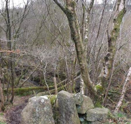
Hide AdBeginning from the car park on Mill Fold Lane, just off Elland Road/B6113, GR SE 040 196 [postcode HX6 4HS] follow the road along the edge of the recreation ground heading towards the River Ryburn. You will pass a scrap yard on the left, and leave the lane as it turns into a driveway. Take the riverside path into the woodland, and at the footbridge, turn left and climb the steps to continue following the river. Looking down into the water there are a myriad of colours visible as the sunlight filters through.
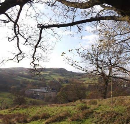
The river curves to the left and you’ll reach a point where you can turn right and cross a bridge, instead continue straight ahead, a way marker indicates the path. The path opens out into a field, you will cross a rickety-looking wooden bridge, with woodland rising steeply to your left. Continue across the fields; you’ll see a beautiful mill building with a clock tower across the valley.
Starting to climb slightly, trace the edge of the woodland and curve away from the mill building crossing muddy ground until reaching a metal gate. Pass through the gate and turn right onto the road. To your left, the road descends to a ford at the bottom. Climb up the road - Hall Green Lane - when this road bends to the left, continue straight onto Smithy Lane. Ahead you’ll see the spillway of Booth Wood Reservoir sitting alongside the motorway. The land to your right descends steeply; this is Booth Dean Clough. Following the road, you’ll see a muddy path to your right, easily spotted by the presence of a large yellow storage container. The ground is extremely boggy next to the container, hence the need perhaps for a sledge!
You can continue to follow the road; it continues towards the reservoir, before bending back around to meet the main road. If you choose to squelch your way through the mud, it is a slippery descent into the clough. Walk to the edge of the field then turn right to descend towards a footbridge. Crossing the footbridge, the path is quite clear, and you will reach a way marker giving the choice of left or straight ahead. Choosing the latter, you will pass a stone stile, beyond which is a stone footbridge at the bottom. Cross the bridge; here take the steep steps ahead up past the old buildings.
Advertisement
Hide AdAdvertisement
Hide AdAt the top you meet the main road. Turn left - you can cross the road to walk safely on the pavement, as it is quite a busy thoroughfare. You’ll see the car park on your left, beneath the reservoir, next to which there is a way marker indicating a track to your right. Follow this track and you walk up to a collection of houses - the footpath passes through a couple of gates and alongside the houses.
Leaving the houses behind, the path meets a quiet road – Pike End Road. Turn right; it’s a quiet lane with pretty views and is kinder underfoot than before. We chose to continue along the lane, but you can, if preferred, turn off the road to your left, following a path that takes you past the rather grand Rishworth Lodge; beyond which there is a path to your right that will take you across the moorland to reach Ryburn Reservoir.
The road twists across the countryside and eventually meets a junction, where if turning right would lead back into Rishworth. Continue straight ahead; a path leads down a track taking you again down what looks to be a driveway.
Pass between the houses, turning left and then right. You’ll see another ‘driveway’ to your left; take this, going past a small collection of houses – marked on the map as Cheetham Laithe – [Laithe, for those, like me, who aren’t originally from Yorkshire means barn] and you do indeed pass what looks to be a converted barn. Following the edge of a field, you enter woodland, and shortly thereafter you climb a stile and meet the edge of Ryburn Reservoir. I’d recommend crossing the reservoir; there is a picnic area on the other side, and you do get a lovely view of the water.
Advertisement
Hide AdAdvertisement
Hide AdEither before or after the crossing, you can descend, taking a path on the right signposted ‘Bar Lane’. We took the steps down and from there it is a gentle stroll back to Ripponden past houses whose occupants must have faith in the strength of the dam above! At the end of the lane, cross the main road. You’ll see a blue plaque commemorating the former entrance to Trestle Bridge, which led to the Rishworth Railway Station operational between 1881 and 1952. Go down the slope next to the Cinnamon Lounge and you’ll recognise where you are; retrace your route along the riverside and your walk is done!